No past acquaintances of mine such as Clarabutt, Hogsflesh or Innocent were as well-suited to their names as Chaworth-Musters. Jim looked unusual – he was unusual – and he had an unusual shade of light mustard hair with a darker mustard suit to match.
We had both arrived at Cambridge in October 1970 and his long, lean, uniquely squareshouldered figure had become a very familiar feature as it drifted through the courts of Trinity like some rare solitary bird. There was nothing unfriendly about his small blue eyes, his long protruding nose or his receding chin, but he neither played games nor chose to mingle in college activities.
We met by chance in our first term through finding ourselves sitting next to one another at dinner and this brought an invitation to coffee in his digs. Books and maps were strewn everywhere, but in a central position on his table was spread an old map of a curious volcanic outcrop in the middle of the Pacific Ocean called Easter Island. His eyes lit up when he saw me examining it.
Easter Island, he explained, was located some 1,600 miles east of Mangareva, the central and largest island of the Gambier Islands in French Polynesia, and a similar distance from Tahiti. The island had seldom been visited since it was discovered and named by its first recorded European visitor, the Dutch explorer Jacob Roggeveen, who encountered the island on Easter Sunday, 5 April 1722, while searching for ‘Terra Australis Incognita’ – the unknown southern continent, as Europeans called it.
The map fascinated me. It showed an island shaped like a cutlet and only 15 miles long by little more than seven miles at its widest point, the meaty end being taken up almost entirely by an extinct volcano Ma’unga Terevaka 1,664.73 ft (507 metres), the highest point, while two other volcanoes, Poike and Rano Kau, form the eastern end of the island.
As we chatted eruditely into the early hours, coffee soon evolved into a bottle or two of Claret, and the conversation turned to volcanoes and it was from this very moment as a young student that I gained a burning desire to visit Easter Island someday – an ambition that was finally fulfilled earlier this year.
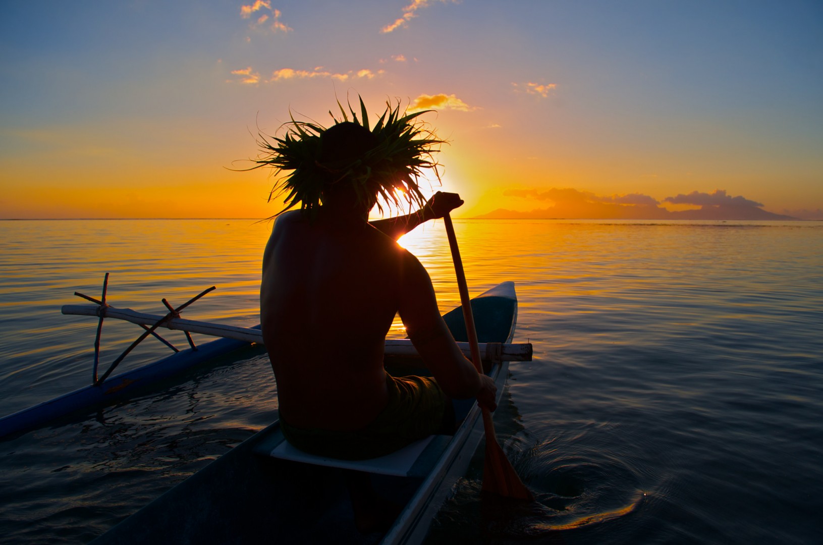
Above: A local fisherman, in his traditional Polynesian pirogue, heads back to the safety of the harbour at sunset. The pristine waters around Easter Island are teeming with fish and other fruits of the sea, which form an essential part of the diet of the Rapa Nui.
It is known by the Polynesians as ‘Rapa Nui’, meaning ‘Big Rapa’, coined after the slave raids of the early 1860s. This refers to the island’s topographic resemblance to the island of Rapa, the largest and only inhabited island of the Bass Islands in the neighbouring Austral Islands group. However, oral tradition suggests Easter Island was originally named ‘Te pito o te Henua’, or ‘The Navel of the World’, which today is often seen as a metaphor for the likely fate of our planet: once a fertile earthly paradise, but abused to such an extent that its inhabitants are being driven to extinction.
In the early 19th century, Pierre Loti the indefatigable French seafarer, artist and novelist, known for his exotic travel novels, wrote of this remote Polynesian idyll in ‘Rarahu’: “There exists in the midst of the great ocean, in a region where nobody goes, a mysterious and isolated island planted with monstrous great statues, the work of I don’t know what race, today degenerate or vanished; its great remains an enigma.”
This tiny spit of volcanic rock in the vast South Seas is, even today, the most remote inhabited island on earth. Its nearly 1,000 monolithic statues – some almost 30 feet tall and weighing as much as 80 tons – are still an enigma, but the statue builders are far from vanished. In fact, their descendants are making art and renewing their cultural traditions in an island renaissance.
To early travellers, the spectacle of these immense stone figures, at once serenely godlike and savagely human, was almost beyond imagination. The island’s population was too small, too primitive and too isolated to be credited with such feats of artistry, engineering and labour. “We could hardly conceive how these islanders, wholly unacquainted with any mechanical power, could raise such stupendous figures,” wrote Captain James Cook, who visited Easter Island in 1774.
Cook freely speculated on how the statues might have been raised, a little at a time, using piles of stones and wooden scaffolding; and there has been no end of speculation, and no lack of scientific investigation, in the centuries that followed. By Cook’s time, the islanders had toppled many of their statues and were neglecting those left standing. But the art of Easter Island still looms on the horizon of the human imagination, and a fitting testament to this exploratory Age of Enlightenment can now be seen closer to home at the Royal Academy of Arts fascinating ‘Oceania’ exhibition, which opened to the public on 29 September and runs until 10 December 2018, marking 250 years since Cook’s first voyage to the Pacific, and celebrating the dazzling and diverse art of the region of Oceania, from the historic to the contemporary.
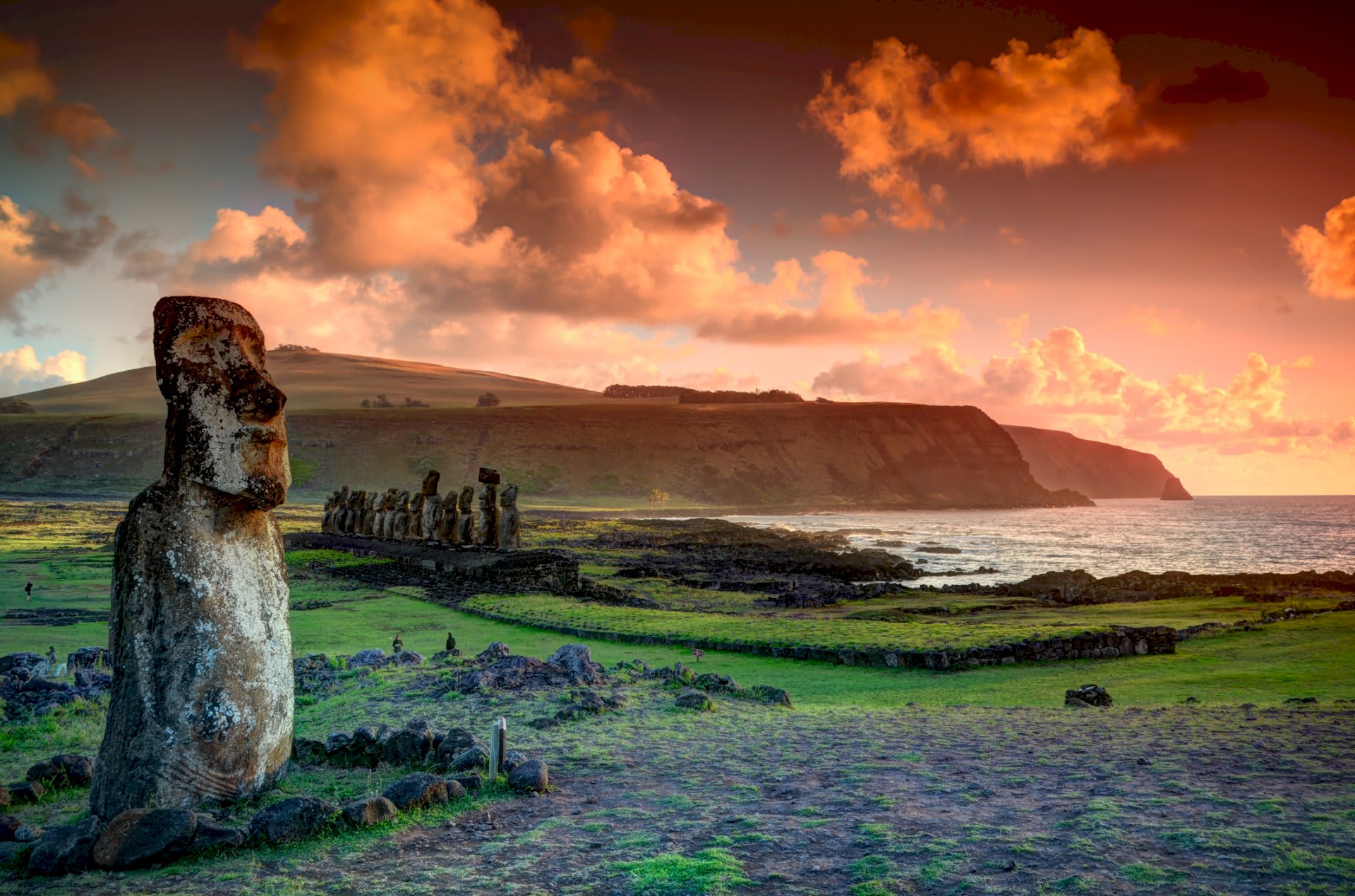
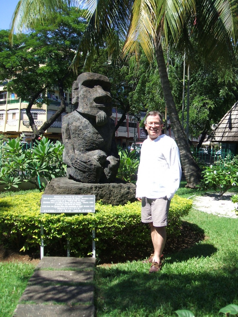
The monolithic statues of Rapa Nui called ‘moai’ are sublimely beautiful works of art. Tall figures carved out of volcanic rock between the 11th and 14th centuries by Polynesian settlers, they have long, unsmiling faces, elegant, hawk-like noses and brooding brows, several of which bare a curious resemblance to ChaworthMusters, my old chum at Cambridge. They can seem alienating or enthralling, depending on the angle, the light, your mood and the weather.
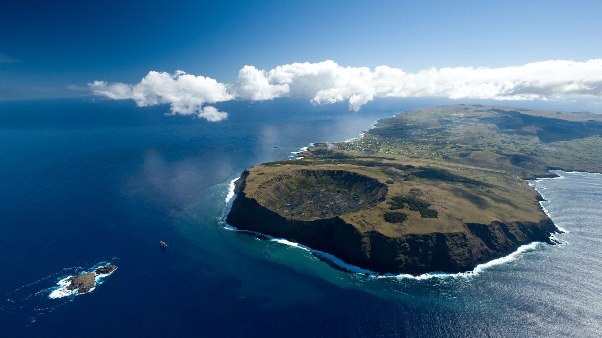
Rapa Nui is a tiny island roughly the size of Jersey. Some 2,300 miles from the coast of Chile, the island is treeless, dotted with volcanoes and fringed with sandy beaches. High waves often lash its western shores, making it a magnet for surfers.
This setting – and the hundreds of ancient moai – have turned much of Easter Island into a UNESCO World Heritage Site and an increasingly popular tourist destination. Its permanent population is around 5,200, about half of whom are of Polynesian descent. In 2017, 91,872 visitors came, most by plane from Chile, though some tourists fly in from Lima or from Australasia via Tahiti. Occasionally, cruise ships make short stopovers here.
I flew into Easter Island with LATAM Airlines from Santiago, the bustling capital of Chile. The flight from Santiago to Mataveri International Airport at Hanga Roa on Rapa Nui, took just under six hours, which is a relatively short flight for routes across the Pacific. The airport is the main entry point for thousands of visitors who flock to Easter Island every year to see its famous moai statues carved by the Rapa Nui people, and to marvel at the tortured topography of this tiny little island.
For such a small island, the airport’s single 10,885 ft (3,318 metre) long runway is one of the longest in the world and starts just inland from the island’s southeast coast at Mataveri and nearly reaches the west coast, almost separating the mountain of Rano Kau from the rest of the island.
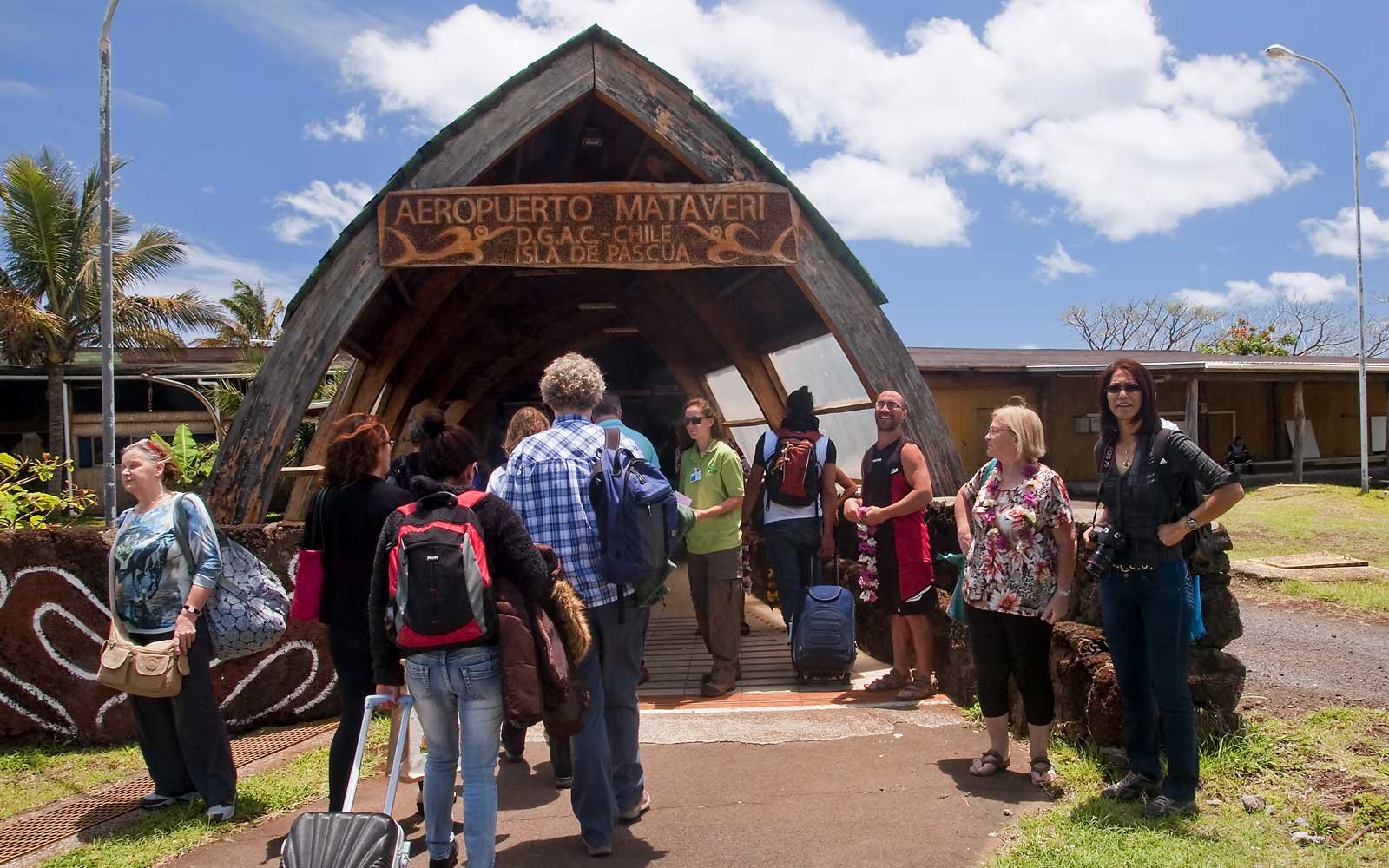
ABOVE Despite boasting one of the longest runways in the world, the single terminal at Mataveri International Airport is exceptionally modest by comparison. The airport is the main entry point for thousands of visitors who flock to Easter Island every year to see its famous moai statues.
The airport was once designated as an abort site for the US Space Shuttle when polar orbital flights from Vandenberg Air Force Base in southern California were planned, with this space launch activity then subsequently being cancelled. The project undertaken by NASA to lengthen the runway was completed in 1987 and enabled wide-bodied jets to use the airport, which further boosted tourism to the island.
Easter Island’s sites differ from most other ancient ruins because of the ongoing mysteries that continue to surround the moai and their makers. Were the gigantic statues gods, shrines or conduits to the heavens? How were they moved? How did the original Polynesians voyage here? Why are there no trees? Did some natural or man-made cataclysm befall the population? What do the present Rapa Nui – the name for the people as well as the island – get from the moai now, if anything?
To the chagrin of native-born islanders, Chilean settlers – and there are many – insist on calling their adopted home ‘Isla de Pascua’ (Easter Island), the island’s official Spanish name. Carbon dating of artefacts on Rapa Nui indicates that Polynesians landed on the island they call Te pito o te Henua around 700 AD. Settled in tribes, they practised slash-and-burn agriculture and built canoes, eventually wiping out the island’s 16 million trees. This, or internecine wars, or rats, or European diseases – theories abound – brought a population of as many as 12,000 down to just 111 by 1877.
Chile annexed Rapa Nui in 1888 but allowed a Scottish firm, the Williamson-Balfour Company, to run the island as a large sheep farm until 1953 (with locals penned in at Hanga Roa). Spanish is the first language, though the Rapa Nui still speak their language (also called Rapa Nui). Many islanders today have Chilean roots, and South American food, social mores and customs are inevitably eroding local traditions.
The Rapa Nui – in common with all Polynesians are exceptionally gentle, friendly people – but the repression of these indigenous islanders by the Chilean government, has had very little, if any coverage in the press and media. It’s a telling fact that speaks well to the abysmal state of the world’s media, who seem reluctant to provide fair and balanced news. It’s an embarrassing failure that we shouldn’t take lightly given that the media has such an obvious effect on politics – that is of course, on the issues it reports and on the issues it does not.
I had the good fortune to spend almost a month on the island, but if you only have a couple of days here, a handful of essential sights shouldn’t be missed. The most important will be the ‘ahu’, the ceremonial platforms on which stand the moai. The figures originally had eyes of coral and obsidian; on the beach at Ahu Tahai near Hanga Roa, you will see how they looked thanks to a reconstruction.
The most photographed site is Ahu Tongariki, where 15 moai stand looking towards the hills – moai face inland as they were guardians of the scattered groups that dwelt on Rapa Nui. The best time to visit them is dawn or dusk for the most dramatic views and photographs of the eerie monoliths.
A visit to the birthplace of the moai at Rano Raraku, is a must-see visitor attraction. This deserted quarry was once a hive of industry. Most of the moai were sculpted here and dozens of statues still remain, 397 in total: a few standing, some fallen, several unfinished. These are still connected to the rock in various stages of incompletion.
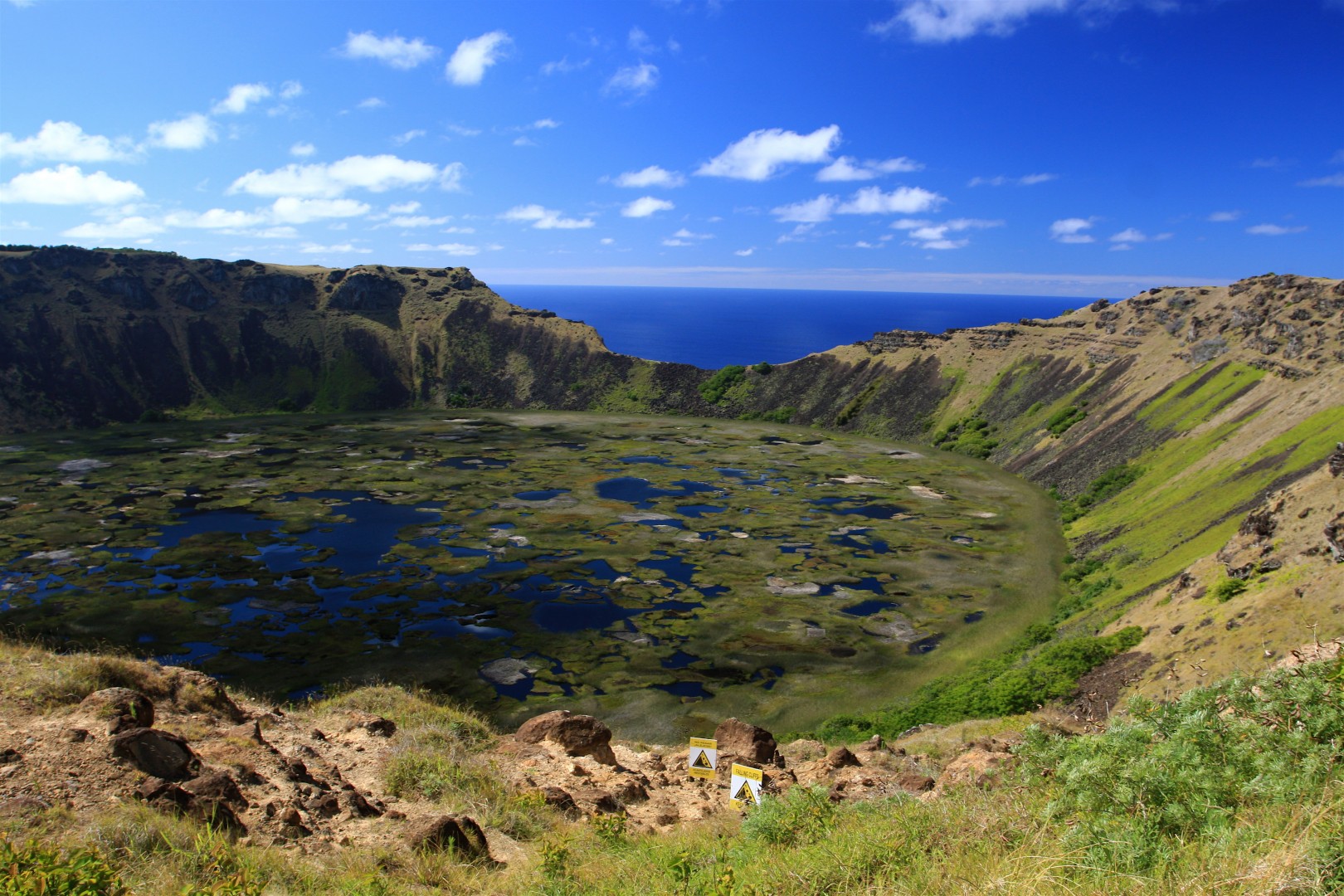
Above: On a southwest promontory of Rapa Nui, you will the immense extinct crater of Orongo, which encloses a freshwater lake and is one of the island’s main water sources. Its surface is speckled with marshy clumps of vegetation that are famously fertile. Islanders grew strawberries and rice here before the area was declared a UNESCO World Heritage Site.
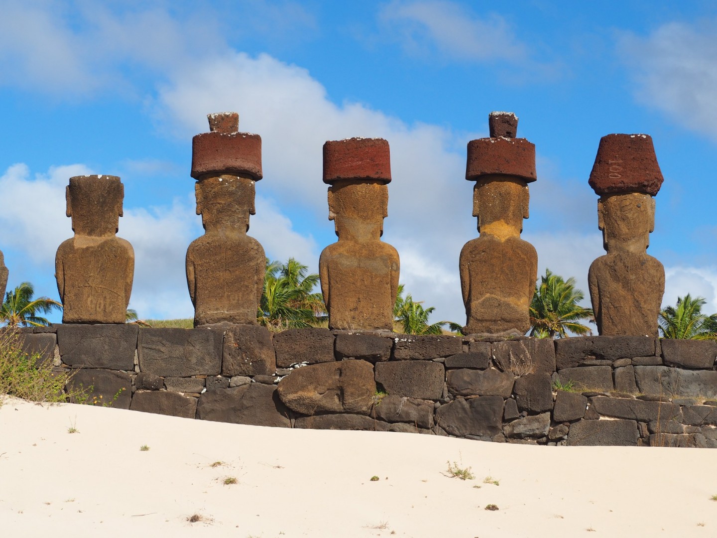
Many other moai stand above the beaches. Anakena, on the north coast, has a platform on which stand five more or less complete moai on sand dunes above the beach. There is also a single, rather wide-bodied figure in a loftier position.
Almost all the coastline of Rapa Nui is rocky and rough. Pieces of land that wouldn’t misfit the west coast of Ireland. But on the north coast of the island, suddenly there’s a soft break in the pitch-black landscape. An inland bay just pops up out of the blue and softens the outlook of the island with golden sand, a gorgeous coconut grove, crystal clear water, calm waves and free ranging horses in the grassy hills behind the moai. Such a welcome place.
Anakena was my first stop on Rapa Nui. After the long, overnight flight from Chile, it was such a dream landing on this pristine strip of land. But Anakena is much more than the biggest and most beautiful beach on the island, it’s a legendary place. According to oral history this is the spot where the first king, and legendary first settler Hotu Matu’a disembarked around 700 AD. That makes sense, since this is probably the easiest strip of land to enter with a canoe. So Anakena basically represents the start of the Rapa Nui culture.
The real highlight here is the nearby Ahu Nau, a group of moai distinguished by their red pukaos (topknots). Carved from a light-red rock called scoria, they confer extra status on a moai. The presence of pukao bestows on a moai the likeness of a chief or royal figure.
A short walk from the crater, the clifftop village of Orongo demonstrates the evolution of the Rapa Nui people’s religion. It consists of the low-lying ruins of stone dwellings, patterned with petroglyphs of anthropomorphic bird-like figures. If you look out to the ocean from a viewpoint in the village, your gaze comes to rest on an uninhabited islet of jagged rocks, known as Motu Nui. Its crannies shelter sooty terns.
After the islanders had lost faith in the moai, they embraced the ‘birdman’ religion. This belief system centred itself around an annual competition. The goal: to collect the first unbroken sooty tern (manu tara) egg of the season from Motu Nui, then swim back to the mainland, climb the sea cliff of Rano Kau to Orongo, and be the first to return with an unbroken egg. What I found intriguing whilst I was there was that the winner of this contest was deemed so sacred, he was then shunned from society.
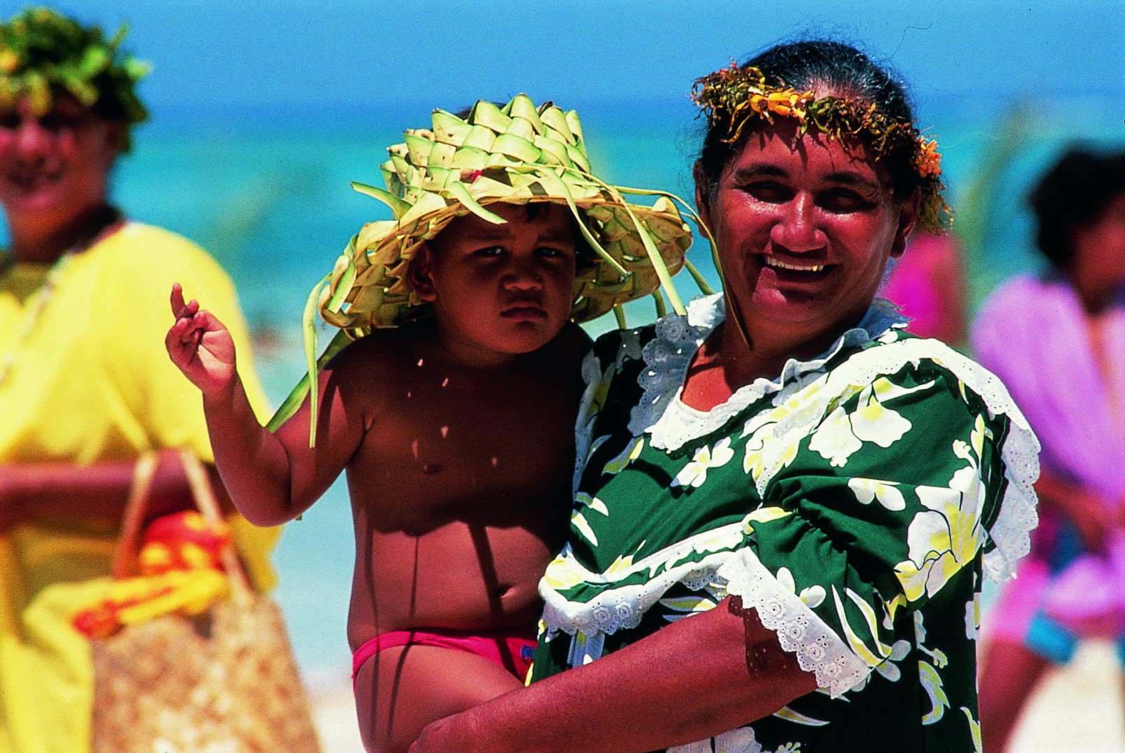
Although Easter Island is set up for foreign visitors, it’s still possible to get an insight into the modern Rapa Nui culture if you look for it.
On the streets of Hanga Roa – a laid-back town of wide roads, squat bungalows, freeroaming chickens, and a harbour – you’ll hear the Tahitian-like native language spoken (Spanish is a second language here). This, the tiny capital of Easter Island, is the only sizeable settlement and is where most of the hotels are found. Locals proudly bear traditional ancestral tattoos in many designs. The highlight of their calendar is February’s spectacular Tapati Festival, involving body painting, dancing and sliding down hills on banana leaves.
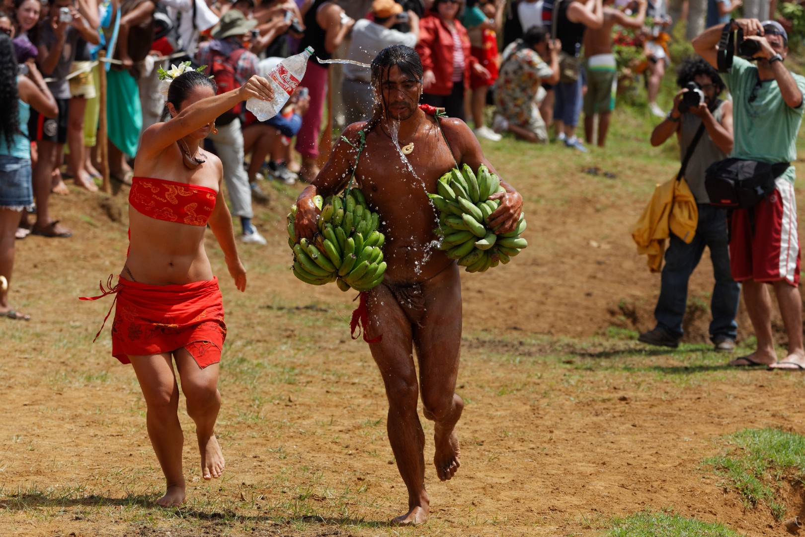
Above: The highlight of the social calendar of the Rapa Nui people is February’s spectacular Tapati Festival, which involves body painting, dancing and sliding down hills on banana leaves.
Try to have dinner at one of Hanga Roa’s seafood restaurants overlooking the picturesque harbour or surrounding ocean. Here, you might see the locals taking part in the island’s main sport – racing in Polynesian-style open canoes.
If you have time, I would urge you to take the half-day trek to Easter Island’s highest point, the imposing peak of Ma’unga Terevaka. From an exposed ridge on the summit of the volcano I was able to survey the whole land mass, while below, white-tailed tropicbirds circle on the updrafts. From this vantage point, the moai were little more than tiny dots on the coastline, overwhelmed by a cobalt ocean stretching out to the horizon.
The heaviest piece of luggage we tend to drag along with us when we travel is the weight of our expectations. But rarely is the load heftier than when heading to a land that has so much mystery attached to its history as Rapa Nui. But don’t expect a tropical idyll covered in swaying palms. This is a place of wind-whipped, barren grasslands with very few trees or rivers, fringed by the oversized heads of the ancient moai.
Devotedly carved, then willingly destroyed by their creators, the moai’s history and existence is stranger than fiction. Numerous theories abound over their meaning, but you’ll find that you leave Easter Island with more questions than answers.
All photos: © Peter Holthusen

